Most sections through this subdivision are MULTI USE, except where noted.
From Kingsvale, the railbed travels in a southerly direction with little views or features until it passes underneath Highway #5 about 2.5km later.
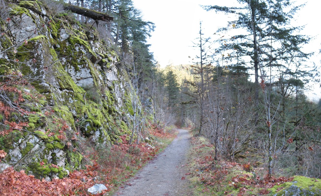
After passing under the highway, there are some pleasant views that can be had along the next 3.5 km's, especially during Autumn, until the railbed intersects the road to Brookmere at N 49.853783° W 120.907515°.
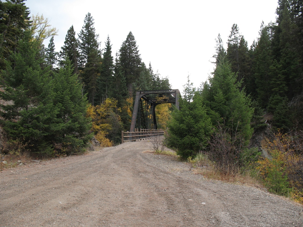
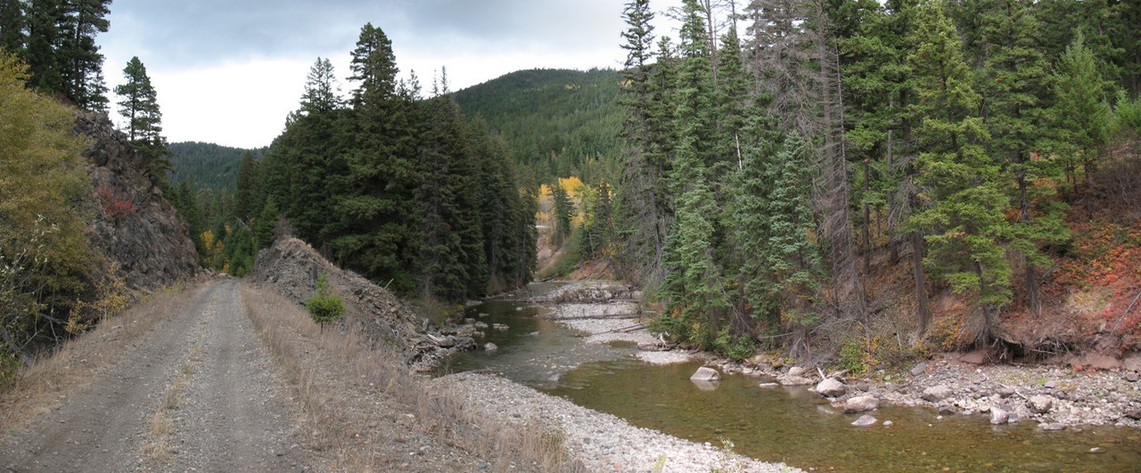
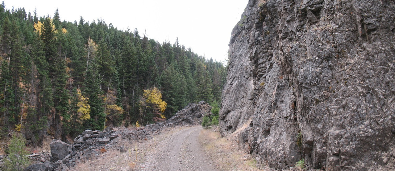
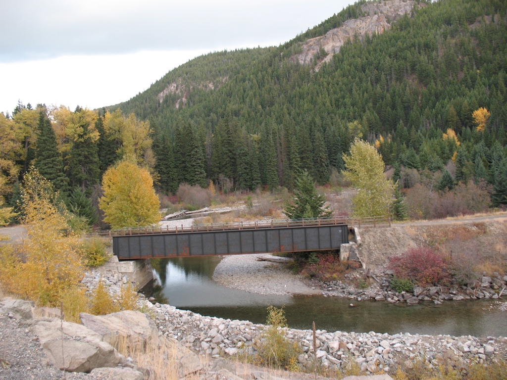
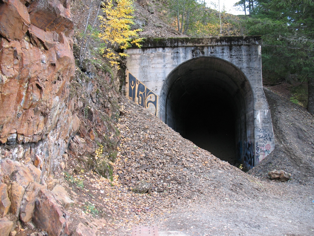
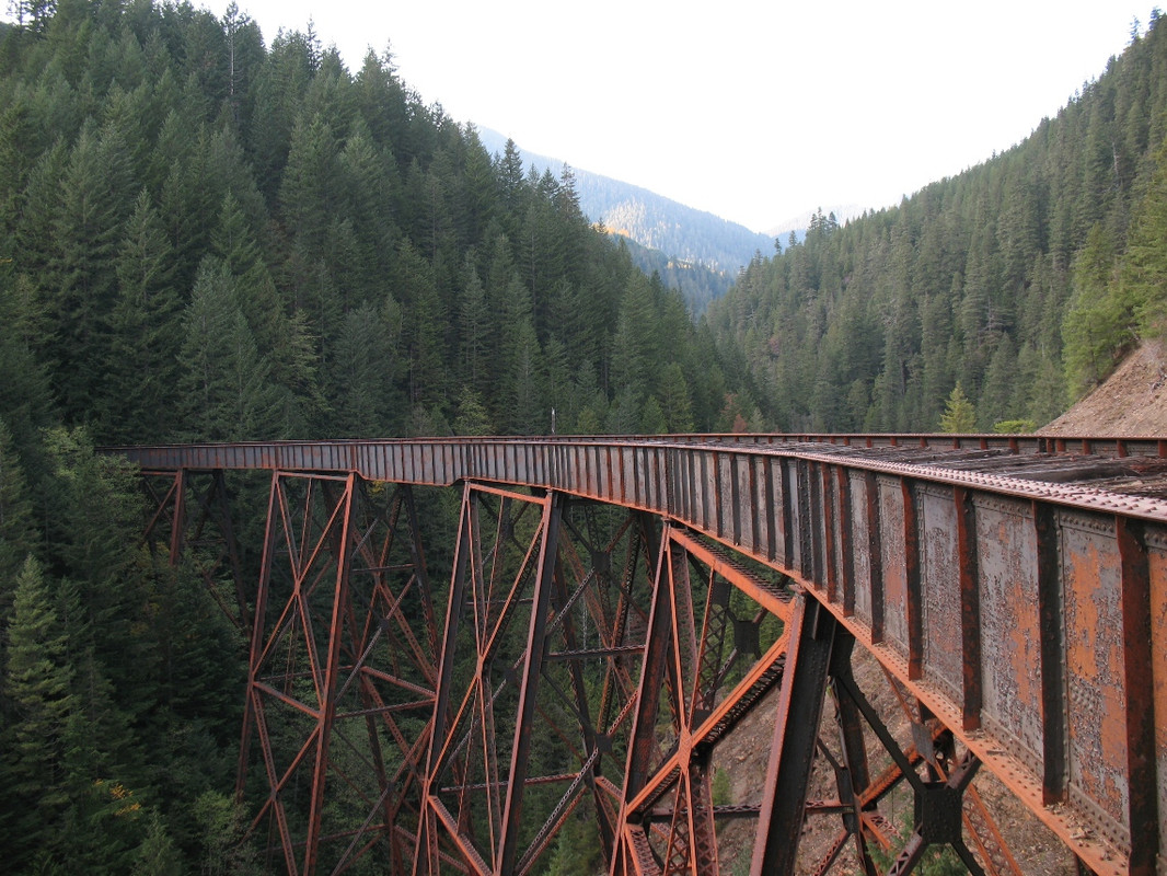
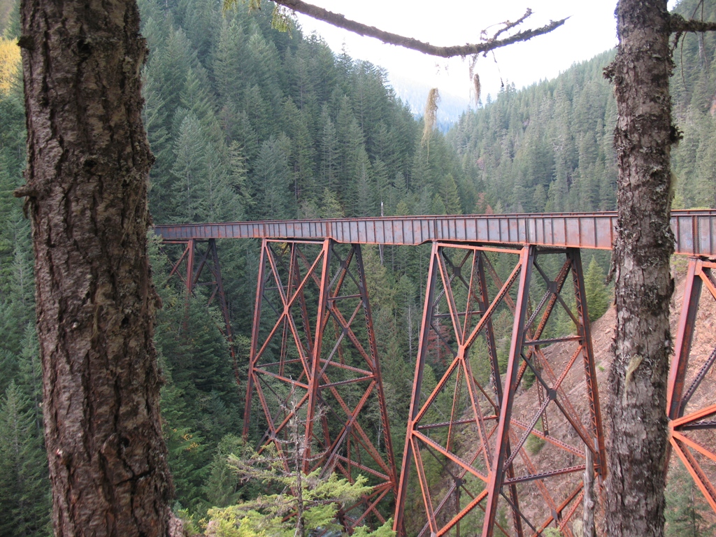
The next 5.75 km's are far more picturesque than the last six. The railbed follows the Coldwater river and crosses it several times, on its way to the Brodie Wye. There is much scenery along this leg; canyons, huge rock cuts, some awesome swimming/fishing holes and five trestles.
From Brodie, the trains could continue south to Hope, or east to Brookmere and beyond. The railbed that goes south has long since been covered by what is now the Coquihalla highway, although some sections remain. For this journey, we will continue eastwards.
Shortly after leaving the Brodie Wye, the rider will encounter a small washout that has eradicated the railbed. Fortunately, some handy individuals have created a route around this slide and a careful rider should have little problem in navigating this bypass. Those who lack the confidence can easily walk their vehicles through here. There is also a second bypass created, but that one is accessed from the railbed across the river at N 49.819510° W 120.933624° , between the first and second bridges about 800m northeast of the bridge at Brodie.
(June 2020) Shortly after this bypass, is a slide at a rock cut in the trail. Although it may look daunting at first glance, there IS a path through it.
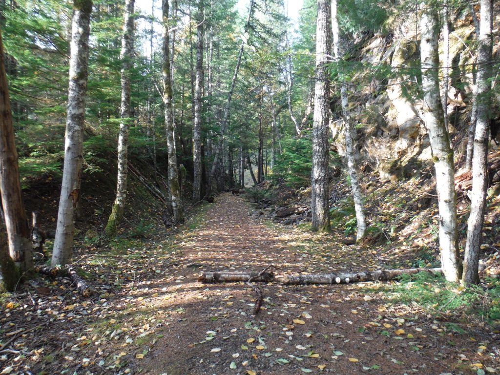
Approximately 1 km north of the slide, the railbed turns east on its way to Brookmere and while there may have been some scenery between Brodie and now, the rest of the route to Brookmere is without any sort of awe-inspiring views. In fact, I would dare say that this particular section is the LEAST appealing of the entire KVR route. Aside from a couple of bridges, there is basically nothing to see until you reach the Brookmere water-tower, approximately 7.2km after leaving the bridge at Brodie.
We investigated parts of this area in person on October 01, 2022 and this is what we discovered.
A section of KVR crosses Coldwater road just west of Brookmere. From this junction, the KVR going North towards Kingsvale and Merritt, has been washed out completely in sections. As such, the trail is blockaded shortly after leaving Coldwater road.
The KVR travelling South towards Brodie fared no better as there was one massive washout about 200m from Coldwater road and another one shortly after that. The railbed looks to be in decent shape for a while after that, but since we were unable to travel the route, I am just going by Google Earth images of the area. The five trestles along this section appear to have survived, but I don't know about their condition; the trestle at Brodie has vanished.
After the Brodie Loop, the section that travels east towards Brookmere suffered multiple slides and washouts; both small trestles along the way are gone.
East of Brookmere suffered two major slides that wiped out large portions of the trail.
It is unknown, at this time, when or IF any repairs will be made to this trail.
In Autumn of 2019, we also cycled a short portion of the KVR trail in Hope, BC. Starting from a small parking area at the end of Kettle Valley road (N 49.373977° W121.406304°), the trail enters the forest and begins a slow climb. This entire section, from the parking area...through all tunnels and beyond to where the road is paved...is NON MOTORIZED.
Along this portion, there are only a few views to be had...mostly of the river roaring below. There are several rock cuts along the route, but none of them are particularly impressive or remarkable when compared to others encountered along the length of this railbed. Within a half hour, we reached Tunnel #13 at the Coquihalla canyon, 3.5 km from the beginning.
Unfortunately for us, Parks BC had closed the tunnels down due to "dangerous conditions" which can occur during the colder months when icicles can form in the tunnels and fall without warning. We will repeat this ride next Spring.
The Othello Tunnels were hit particularly hard by the flood waters. The river runs alongside these, so it stands to reason that they wouldn't be spared.
From the pictures and videos I've seen, the two northernmost tunnels were hit the worst. It would appear that the river rose high enough that a portion of it actually flowed through the first tunnel, carrying much debris in its wake, and eroding the tunnel floor in the process.
It is going to take some time to clear the mess...I can't imagine this attraction being open for the 2022 season....but I could be wrong.
Check with https://bcparks.ca/explore/parkpgs/coquihalla_cyn/ before making the trip.
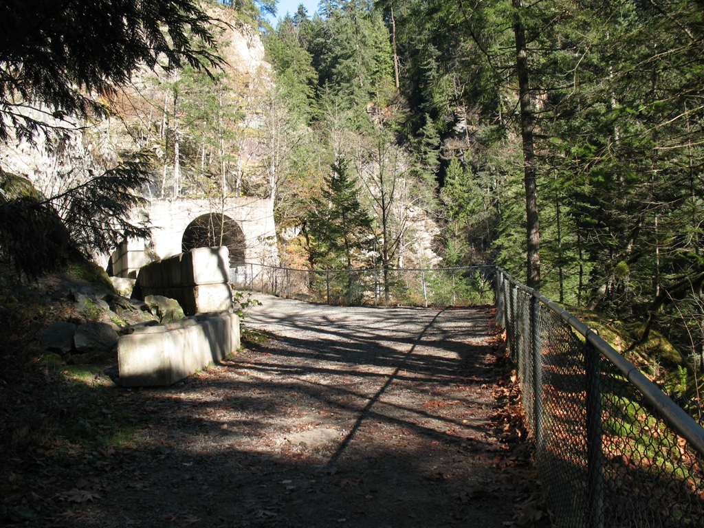
Between the Coquihalla Canyon and Brodie station, there is another "point of interest" along this old railway; the Ladner tunnel and trestle. This section is also NON MOTORIZED and one of the only points along the entire rail trail that can only be accessed on foot, and getting to the trailhead can be precarious at the best of times. You will need to travel south-bound along Hwy #5 (the Coquihalla Highway) and park at the east end of the Ladner Creek bridge...near N 49.494577° W 121.240101° and pick up the nearby trail. It should be well marked as it is well-traveled, but if it has become overgrown from lack of maintenance, you should travel up the hill in a north-easterly direction. Once you have reached the top of the knoll, the trail will level off and should become more visible as it follows the old railbed.
After a short walk (less than 1 km), the Ladner tunnel should come into view.
The brave can follow the narrow, dangerous trail up and over the tunnel, to the other side...
or you can simply view the trestle from the same trail, without going down the other side.
Visiting this feature involves many layers of danger, from parking along a downhill stretch of busy highway, to clambering around a collapsed tunnel using ropes and cables of unknown origin. Needless to say that caution must be exercised...a slip or fall, anywhere near the tunnel or trestle WILL BE fatal.
Update: April 2022...The trestle has now been fitted with chain-link fencing to prevent people from walking across. It remains to be seen how long this fencing will last.
In late August of 2020, I was able to access another section of KVR that runs through the Coquihalla Subdivision. Since this particular area is currently "restricted access" I will not provide directions, but the clever readers will understand where this section is.
I followed some dirt tracks until I am across the valley, looking back at the Coquihalla highway.

I jump onto the track that I have labelled as the old KVR railbed. Soon, it is obvious that I am on the right track - pardon the pun.
 |
| Old railbed |
It's always amazing to see some of the rock cuts that were necessary to facilitate this project...

It is not possible to follow the railbed exclusively, from end to end as some of the bridges are missing and most of the tunnels are collapsed, so it is necessary to use the existing road instead. In many instances, the old railbed runs along the road, as is evidenced by this old telegraph pole.

After a few miles, the remains of Iago Station are marked.
 |
| Iago station marker |
There are some cement/concrete footings along the roadside...maybe they were for a water tower, maybe they were for a building...

Not long after, the old snow-shed appears.

Still seems to be in good condition, given its age....and still holding up under the TONS of snow it sees every year!
 |
| Snowshed |
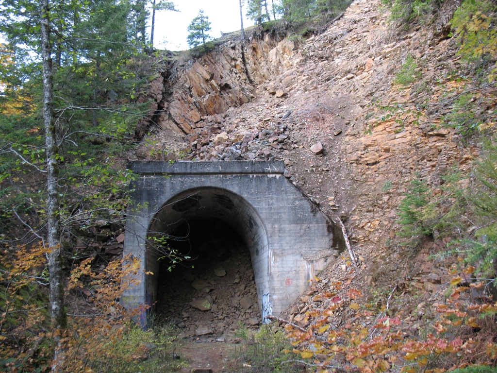
Less than 1 km down the road, the next feature comes into view...

Extensive amounts of wooden cribbing holds the ceiling of this short tunnel...still in remarkable shape, considering it was completed in 1944!

Less than a km further, another bizarre feature, but this one is natural.
The famous Hole in the Wall!
Water gushes from a hole in the rocks above and disappears into another hole in the rocks, a few feet below. Apparently, the flow can be quite intense during freshet...
 |
| Hole in the wall |
After the Hole in the Wall, the road drops to the valley floor and becomes a bit less spectacular. There is still plenty to see, but between markers 15 and 18, you are mostly in the trees, with an occasional view of the railbed, across the river and up the hillside.
Eventually, you will reach the remnants of Romeo station, as indicated by this sign, but there are no remains to be seen in the immediate area.

Unlike most "stations"...there is nothing obvious in the area to suggest there was ever anything here! There is no water-tower base, no footings, no old timbers...
On October 09, 2022 we visited this area and although the snowshed and Iago tunnel avoided any damage from the rains, the Old Coquihalla Lakes road did not. There are numerous slides and washout along its length but the GOOD NEWS is that the Pipeline Construction crew is repairing these as they go along.
Because of their on-going repair efforts, we were not able to travel this route in its entirety...we were turned back about 5 km from the eastern end of the route, so I cannot report on the condition of the road or any of the tunnels that remain.
This caught my eye as I drove...old bridge abutments, but no decking. This is what I meant when I mentioned that there was no way to stay on the railbed for this entire trip...

As you continue...you will see several more tunnels on the hillside...and old telegraph poles.

But, as mentioned, most of the tunnels along this section have collapsed.

If a tunnel goes into a mountain...it has to come out the other side! Strange that this same tunnel has different dates on either end.

As you can see...this is no longer a "tunnel"...
 |
| Collapsed tunnel |
This one had the ceiling collapsed...you can see daylight shining in from the top.

Continuing on, you will eventually reach a gate...what you do from this point is up to you. If you decide to go under or around the gate, you will emerge in a familiar location.
This area will become accessible in another couple of years, but while in the area I was met by dozens of cyclists and a few other riders.
No comments:
Post a Comment