Please
take into consideration that this writing was several years in the
making; things have changed from one year to the next as we completed
this trip a section at a time. All distances mentioned are
approximate.
This entire section is MULTI-USE except where noted.
This entire section is MULTI-USE except where noted.
Flood Update 2022
Much of the railbed from Brodie to Brookmere was damaged extensively during the November storms of 2022. Reports are that many of the homes in the Brookmere area suffered some damage as well.
By viewing the are via Google Earth, you can get a sense of the destruction that occurred East of Brookmere. Some large sections were badly damaged by slides and washouts.
By viewing the are via Google Earth, you can get a sense of the destruction that occurred East of Brookmere. Some large sections were badly damaged by slides and washouts.
Check out this video:

Brookmere water tower and original base.
Finding the railbed in this area is simple enough; just get a map and drive to Brookmere. Once in "town" the first thing you will see is this water tower, and the railbed runs directly in front of it!
The Brookmere water-tower stands at N 49.818097° W 120.871991° as the LAST of its kind along the entire route from Hope to Midway. A sharp eye will notice the concrete bases at several locations along the route, but the tower at Brookmere is the last standing remnant of this era. The tower itself was relocated to private property, the base still sits near the edge of the railbed.
This water-tower is one of the most
photographed features along the KVR.


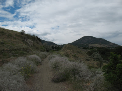
The
next 9.6 km's from Brookmere to Thalia are best experienced in late
September, when the poplars, birch and maple start to turn. Along
this stretch you will find a real feast for the eyes as it meanders
between the hills towards the Otter Valley and yes, there is even an
outhouse if you need it at N 49.773572° W 120.768901°.

When you reach Thalia, you will need to take a small detour as the trestle across Coalmont road no longer exists; there are many stories as to who set it on fire, back in the 90's. Some charred posts and wood still remains.


When you reach Thalia, you will need to take a small detour as the trestle across Coalmont road no longer exists; there are many stories as to who set it on fire, back in the 90's. Some charred posts and wood still remains.

Remnants of Coalmont trestle
Once
you regain the railbed on the south side of Coalmont road, it
meanders some more across range land, all the way to Otter Lake;
expect to find many gates along the way. For the next 19.5 km's you
are travelling through open range, across several bridges and through
many sections of "whoops" all the way to the northern tip
of Otter Lake. From there, it is another 5 km or so of scenery, as
the railbed hugs the lakeshore, all the way to the footbridge at the
southern end.
Once
you reach the township of Tulameen, you can get food, fuel and more
at the Trading Post/General Merchandise Store at N 49.545394° W
120.758751°
The
next section of railbed from Tulameen to Coalmont is unremarkable for
the next 2.5 km's until you start to travel along the river's edge.
Here the surface can vary; one year we found it to be smooth, the
next year was loose and dusty. The river provides many fishing and
swimming holes, although it can be very low in Autumn.

It is approximately 6.2 km from Tulameen to Coalmont, but the railbed passes just to the northeast of town so unless you divert, you won't see it. The Coalmont area is worth a visit for its historical appeal; the ruins of Granite city and the cemetery uphill from the site, as well as the coal-mining ghost-town of Blakeburn located a few kilometers west of Coalmont. Here, the Tulameen river is the only river in the world where gold and platinum are found alongside each other.
Once you've left Coalmont, about 3.75 kms from town and just before crossing a trestle, there is a road that cuts to the left and drops into a makeshift campsite, with fire rings and outhouses. The attraction here, is the beautiful white sandy beach which the locals have appropriately named White Sands, at N 49.496970° W 120.648682°. A picturesque place to stop for a rest!


Traveling along the Tulameen river
It is approximately 6.2 km from Tulameen to Coalmont, but the railbed passes just to the northeast of town so unless you divert, you won't see it. The Coalmont area is worth a visit for its historical appeal; the ruins of Granite city and the cemetery uphill from the site, as well as the coal-mining ghost-town of Blakeburn located a few kilometers west of Coalmont. Here, the Tulameen river is the only river in the world where gold and platinum are found alongside each other.
Once you've left Coalmont, about 3.75 kms from town and just before crossing a trestle, there is a road that cuts to the left and drops into a makeshift campsite, with fire rings and outhouses. The attraction here, is the beautiful white sandy beach which the locals have appropriately named White Sands, at N 49.496970° W 120.648682°. A picturesque place to stop for a rest!

"White Sands"
Leaving
White Sands, the railbed crosses to the west side of the river and
travels through some more unremarkable terrain until it crosses the
river again 3.5 km's further. Now, back on the east side again, we
travel for another 2 km before encountering a slide at N 49.462083°
W 120.613351°. Once past the slide, we travel for another 1.2
km...following the contour of the hillside until we reach the Parr
Tunnel, our first at N 49.456977° W 120.603342°. It is a curved
tunnel with absolutely no interior lighting so riders should stop and
allow their eyes to acclimate to the darkness, otherwise there is no
telling whether the tunnel contains other riders, pedestrians or
animals. This is one of the darkest tunnels along the route, due to
its curvature. Shortly after exiting the Parr Tunnel, you will see
the Parr gazebo, built by the Vermillion Trail Society.

This serves as another nice place to stop for a rest, a meal, or just to admire the countryside. Upstream of the gazebo is an old wooden trestle that appears to have been washed off its foundations.
Past the gazebo, keep your eyes open for the red cliffs and hoodoos along the trail.

The railbed travels for another 6.5 km, through mountains and farmland, to the foot-bridge just west of the long tunnel under Highway #3. At this point, you have just crossed the Tulameen river. Once through this tunnel, there is only another 150m of trail before encountering the NON-MOTORIZED portion through the township of Princeton. This will require a brief detour along Old Mill road where you will encounter the ruins of an old bridge across the Similkameen river. The two bodies of water eventually merge just past the main bridge in downtown Princeton.

Parr gazebo with Parr tunnel in background
This serves as another nice place to stop for a rest, a meal, or just to admire the countryside. Upstream of the gazebo is an old wooden trestle that appears to have been washed off its foundations.
Past the gazebo, keep your eyes open for the red cliffs and hoodoos along the trail.

The railbed travels for another 6.5 km, through mountains and farmland, to the foot-bridge just west of the long tunnel under Highway #3. At this point, you have just crossed the Tulameen river. Once through this tunnel, there is only another 150m of trail before encountering the NON-MOTORIZED portion through the township of Princeton. This will require a brief detour along Old Mill road where you will encounter the ruins of an old bridge across the Similkameen river. The two bodies of water eventually merge just past the main bridge in downtown Princeton.
UPDATE: June 2021- The powers-that-be have amended the rules regarding the trail usage through the tunnel and into town; Motorized is now permitted, subject to several stipulations regarding right of way to cyclists and pedestrians. The new regulations are posted on the trail shortly after exiting the East end of the tunnel.
While we were in the area, we decided to cycle the small section through Princeton. We picked up the rail-trail near the old caboose, by the Subway in town.

Caboose
The "multi-use" trail is paved and in good shape...watch for pedestrians.

Railtrail through Princeton
We rode through the Princeton Tunnel, under Highway #3 and continued on for a short while past this bridge. We had already driven this section, so didn't bother going any further. At this point, we turned around and rode back through the township, following the rail trail all the way.

Flood Update 2022
According to reports, large sections of the trail, between Coalmont and Princeton, have been damaged, eroded or washed away completely. The bridge shown in the picture above, was damaged and will likely NOT be repaired.
Sept. 2022:
Here is a photo of this bridge, located at the West end of the KVR tunnel under Highway #3 in Princeton.

From Coalmont road, looking down on the railbed. This is roughly halfway between Princeton and the Parr tunnel. You can see that large sections of the railbed have been washed away completely.

East of the old caboose, the trail passes an interpretive kiosk, with information about the railroad, the area and the people involved. It then passes under the Highway #3 bridge; a rough section that you may need to walk. Once back onto the dyke, the trail heads north across the "Bridge of Dreams"

Bridge of Dreams
It continues along, past the Weyerhauser mill and past Rainbow lake. Once we reached the "multi-use" section, we turned around and returned to Princeton.

Nearing Rainbow Lake
Now that the trail is "multi-use", we pick up the railbed again at N 49.481045° W 120.485184°, just west of Rainbow Lake, on the road to Chain, Osprey and Link lakes. We travelled this section on motorbike.

From here to Jura station, was one of the most picturesque sections of the journey so far. The railbed slaloms up the hillside with such a gentle slope that it is barely noticeable, and while gaining elevation, you are treated to the sights of mountains, valleys, isolated lakes, and horizons. We traveled this section in mid-September, so I can only imagine that during May and June, the wildflowers must be amazing.
Soon after crossing the highway one last time, just past Separating Lake, we come across another gazebo erected by the VTS at N 49.542971° W 120.447902° near what was Jura station.

Jura gazebo built on the old water-tower base
The gazebo sits upon the base of the water tower that used to be here. 1 km later, the railbed enters the forest once again.
There are many exits along this next stretch of railbed from Jura to Chain lake. Most roads coming in from the east will eventually take you back down to the highway, although some may cut through private property. If you find yourself inadvertently passing through someone's yard, the best thing is to backtrack and try the next exit; many of those property owners are responsible for maintaining the railbed, so it's best not to irritate them.
8 km past the Jura gazebo is the Erris Tunnel at N 49.600190° W 120.394804°. It is a short tunnel, also known as the China Tunnel because of the peculiar shape of the western entrance. It was built through unstable rock and therefore used extensive wood-bracing. This is one of the last timber-lined tunnels along the CPR/KVR.

South entrance of Erris tunnel
Another
7 km past Erris tunnel is a very high trestle at N 49.653517° W
120.356634° across Spukunne creek. Continuing on from this trestle,
you may catch an occasional glimpse of the valley and highway below,
until you arrive at the remnants of Jellicoe station, some 8 km's
later at N 49.682066° W 120.282394°. From Jellicoe, the trail
continues through the forest for another 5.5 km's before crossing the
highway once again at N 49.717033° W 120.238987° and finally
reaching the community of Bankeir, which encompasses the three larger
lakes in the area: Osprey, Link and Chain.
The railbed passes in close proximity to each of the lakes, hugging the shores of Osprey and Link, to the small trestle at the east end of Osprey. Look for the remains of another water-tower at N 49.715765° W 120.180109°.

On this day, it was our plan to continue onward to Thirsk lake, but an incident at a cattle crossing made us change our itinerary.
In September of 2020...we completed the section from Faulder to Bankeir. While staying in Penticton, we trucked the bike to the start of the motorized section at Faulder and traveled West.
After leaving Faulder, the trail is smooth and wide. There is the occasional section of "whoops" but nothing too radical. There is even an outhouse at N 49.613900° W 119.808739°
The railbed passes in close proximity to each of the lakes, hugging the shores of Osprey and Link, to the small trestle at the east end of Osprey. Look for the remains of another water-tower at N 49.715765° W 120.180109°.

On this day, it was our plan to continue onward to Thirsk lake, but an incident at a cattle crossing made us change our itinerary.
* * *
In September of 2020...we completed the section from Faulder to Bankeir. While staying in Penticton, we trucked the bike to the start of the motorized section at Faulder and traveled West.
After leaving Faulder, the trail is smooth and wide. There is the occasional section of "whoops" but nothing too radical. There is even an outhouse at N 49.613900° W 119.808739°
 |
| Shortly after leaving Faulder...traveling West |
The first "hazard" we encounter is a fairly major washout near N 49.616694° W 119.858552°. There is a section of trail, about 150m long that has vanished into Trout Creek. Someone has built a detour, but in some places the new trail is actually below creek level so it's just a question of how long this route will survive.
Flood Update 2022
According to reports, the rail trail is CLOSED from Dean's road in Summerland to the Crump siding.
Will update as more becomes known...
Will update as more becomes known...
 |
| Detour around washout |
This is from the North end of the washout, looking back towards Faulder.
 |
| Looking back at washout |
Shortly after the washout, we come to the Crump (not Trump) Siding, where we stopped for a picnic lunch.
Not too far from the station, is the base of an old water-tower...
Not too far from the station, is the base of an old water-tower...

 |
| First trestle |
Shortly afterwards, we cross the Princeton/Summerland road for the first time, and drive past the Trout Creek Recreational site. A bit further up the road is this old mine at N 49.653333° W 119.925132°. I don't hesitate in mentioning the exact location of this one as it is probably well-known by the locals, and it only goes in about 6 feet into the mountain...nothing to be vandalized here.
 |
| Old mine |
After the mine, we cross a second trestle and continue to skirt the valley below. We found this viewpoint complete with bench at N 49.692709° W 119.985704°. Unfortunately, the wild-fire smoke of September 2020 obscures what is likely, a beautiful view!

The rail-trail continues to parallel the Princeton/Summerland road, crossing once more before finally arriving at Osprey Lake. Since the previous article covered that area, there is no sense in repeating it.
Once at Osprey Lake, we followed the major road back to the Faulder station, where we traveled East. This section is a bit confusing...the sign showed that motorbikes WERE allowed, yet when we reached the end at Prairie Valley Station, it said Non-Motorized.
So somewhere along the way, the rules changed. But having seen NO cyclists along this entire section of rail trail (probably because of the smoke) we threw caution to the wind.
This is one of the only sections of original KVR that still has track.
 |
| Section of tracks East of Faulder |
Once we reached the Prairie Valley Station, I was lost and didn't know which way to go to get back to our truck, so we back-tracked along the same section that was motorized/Non....go figure.
Decent chunk of trail from here to Bankeir; some sandy sections...some rough. As far as scenery goes, it's difficult to rate, due to the amount of smoke that was blocking the view.
Decent chunk of trail from here to Bankeir; some sandy sections...some rough. As far as scenery goes, it's difficult to rate, due to the amount of smoke that was blocking the view.
September 2021
We were able to cycle a portion of the railbed from Skaha to Summerland this year. This section is entirely NON-MOTORIZED
Unfortunately, you cannot ride from the canal in Penticton to Summerland as the trail passes through a section of land owned by the local Native band.
The plan was to start from the access near Russett Drive along the West Bench, but on this day, there was "bridge maintenance" happening, so we trucked our bikes to an access point near the Wow Golf Club and started from there instead.
Just like everywhere else, this is a nice easy railroad-grade with a couple of rough and/or loose sections but not too bad overall. From where we started, it was about a 7 km one-way trip.
The scenery along the way is awesome, as always:

Okanagan Lake alongside the KVR
Trout Creek trestle...

South end of Trout Creek trestle
It was amazing to note how many "E-Bikes" we encountered along this section. Doesn't that count as "motorized"?
We rode right past our truck on the return, just to see how far we could go. There are access/exits at every bridge you encounter on the way back.
We rode right past our truck on the return, just to see how far we could go. There are access/exits at every bridge you encounter on the way back.

Overpass at Newton Drive
In June of 2023, we re-visited this area to complete a short section of the rail trail (that we were told was OFF LIMITS because it crossed through Native land).
Throwing caution to the winds, we pedalled feverishly from N49.484381° W119.605385° uphill to where we left off at N49.495836° W119.623059°.

There are some "views" along the way...


Great to finally complete this section!
No comments:
Post a Comment